Beauty Unlocked
3 Ways to Calculate Acreage
Jun
Note: This article is based on real U.S. measurement standards, land-record practices, agricultural extension guidance, and GIS mapping principles. Source links are intentionally not inserted into the article body for cleaner web publishing.
Calculating acreage sounds like one of those tasks reserved for surveyors, farmers, real estate pros, and people who own suspiciously large tape measures. But in reality, anyone can learn the basics. Whether you are estimating the size of a backyard, comparing land listings, planning a garden, checking a pasture, or trying to figure out whether a “cute little lot” is actually big enough for your dream workshop, acreage calculation comes down to one simple idea: find the area first, then convert it into acres.
The magic number is 43,560. One acre equals 43,560 square feet. Once you know the square footage of a piece of land, you divide by 43,560 to get acreage. That is the heart of the whole operation. The rest is choosing the right method for the shape and situation.
In this guide, we will break down 3 ways to calculate acreage: measuring a simple rectangular area, dividing irregular land into smaller shapes, and using maps, plats, or digital tools. Along the way, we will cover formulas, examples, common mistakes, and practical tips that can save you from turning a simple calculation into a full-blown geometry soap opera.
What Is an Acre?
An acre is a unit of land area commonly used in the United States for real estate, farming, forestry, landscaping, and land management. It does not describe a fixed shape. An acre can be a long skinny strip, a square, a rectangle, or an irregular patch of land that looks like it lost an argument with a river. What matters is total area.
The most useful conversions are:
- 1 acre = 43,560 square feet
- 1 acre = 4,840 square yards
- 1 square mile = 640 acres
- 1 hectare = about 2.47 acres
If you imagine a perfect square acre, each side would be about 208.7 feet long. That mental picture helps, but remember: most real parcels are not perfect squares. Land has curves, slopes, easements, fence lines, driveways, drainage ditches, and occasionally one mysterious corner nobody can explain.
Method 1: Calculate Acreage from Length and Width
The easiest way to calculate acreage is to measure a rectangular or square piece of land. This method works well for lawns, gardens, fields, parking areas, building lots, and other spaces with straight sides.
The Formula
Use this basic acreage formula:
Length × Width = Square Feet
Square Feet ÷ 43,560 = Acres
For example, suppose a field is 330 feet wide and 660 feet long.
330 × 660 = 217,800 square feet
217,800 ÷ 43,560 = 5 acres
That field is exactly 5 acres. Congratulations, you just did land math without needing a hard hat or a mysterious clipboard.
Example: Calculating a Backyard Lot
Let’s say a backyard measures 150 feet by 200 feet.
150 × 200 = 30,000 square feet
30,000 ÷ 43,560 = 0.6887 acres
Rounded to two decimal places, the yard is about 0.69 acres. If someone calls it “almost three-quarters of an acre,” they are not wildly wrong, though the spreadsheet in the room may raise one eyebrow.
When This Method Works Best
This method is ideal when the land is close to a rectangle or square. It is also useful when you only need an estimate, such as planning sod, fertilizer, seed, fencing, irrigation, or mowing time. In agriculture and landscaping, converting square feet to acres is common because many product labels, equipment rates, and application recommendations are given per acre.
Tips for Better Measurements
Use feet as your main unit to avoid conversion headaches. If your measurements are in yards, multiply yards by 3 to convert them to feet. If you measure in meters, convert square meters to acres using the proper conversion, or convert meters to feet first before calculating.
Measure from boundary to boundary as accurately as possible. For a home lot, do not assume the fence is the legal property line. Fences are helpful visual clues, but they are not always survey-accurate. If the acreage matters for buying, selling, building, or resolving a dispute, use official records or hire a licensed surveyor.
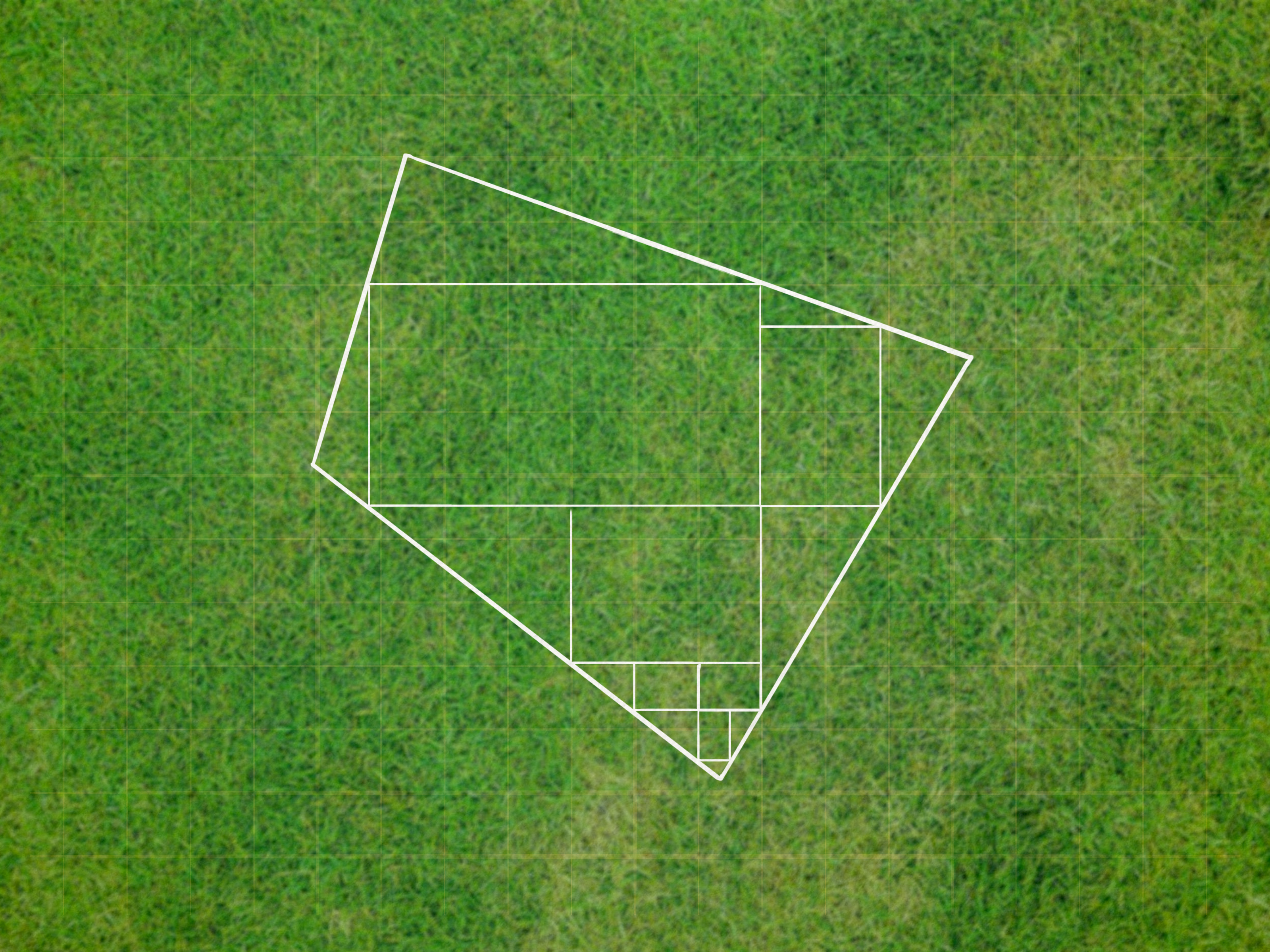
Method 2: Break Irregular Land into Smaller Shapes
Not all land is polite enough to be a rectangle. Some parcels curve along roads, taper near creeks, widen behind a barn, or have an odd triangle-shaped corner that seems designed only to confuse humans. When land is irregular, break it into smaller shapes you can calculate.
Use Rectangles, Triangles, and Trapezoids
The strategy is simple: divide the land into shapes, calculate each area, add the square footage, then divide by 43,560.
Here are the most useful formulas:
- Rectangle: Length × Width
- Triangle: Base × Height ÷ 2
- Trapezoid: (Base 1 + Base 2) ÷ 2 × Height
Example: A Lot with a Rectangle and a Triangle
Imagine a lot with one rectangular section and one triangular section. The rectangle measures 200 feet by 300 feet. The triangle has a base of 200 feet and a height of 100 feet.
Rectangle area: 200 × 300 = 60,000 square feet
Triangle area: 200 × 100 ÷ 2 = 10,000 square feet
Total area: 60,000 + 10,000 = 70,000 square feet
Acreage: 70,000 ÷ 43,560 = 1.61 acres
The parcel is about 1.61 acres. That is a solid estimate if your measurements are accurate.
Example: A Trapezoid-Shaped Field
Now imagine a field where one side is 400 feet wide, the opposite side is 600 feet wide, and the distance between them is 500 feet.
(400 + 600) ÷ 2 × 500 = 250,000 square feet
250,000 ÷ 43,560 = 5.74 acres
This field is about 5.74 acres. Trapezoid formulas are especially useful for fields, roadside parcels, and lots where the front and back widths are different.
How Accurate Is This Method?
This method can be very accurate if the land is measured carefully and the shapes are chosen wisely. The more complex the boundary, the more smaller sections you may need. Think of it like cutting a pizza, except instead of delicious triangles, you get numbers. Still satisfying, just less cheesy.
For curved boundaries, you can approximate the curve with several short straight lines. The smaller the sections, the better the estimate. However, there is a point where DIY measuring becomes less practical. If the parcel has legal, financial, or construction significance, professional surveying is the safer option.
Common Mistakes to Avoid
Do not mix units. If one side is measured in feet and another in yards, convert before calculating. Do not include areas that are outside the parcel boundary. Do not assume that a driveway, tree line, old fence, or mowed edge marks the actual property line. Also, be careful with slopes. Acreage is generally calculated as horizontal land area, not the stretched surface area of a hill. A steep hillside may feel like 10 acres when you are walking it, but math is less dramatic.
Method 3: Use Maps, Plats, GIS Tools, or a Survey
The third way to calculate acreage is to use existing land records or digital mapping tools. This is often the best method for larger parcels, irregular boundaries, wooded areas, farms, commercial properties, or land you cannot easily measure by hand.
Using a Property Plat
A property plat is a map or drawing that shows parcel boundaries, dimensions, easements, roads, and sometimes acreage. Plats are commonly used in real estate transactions, subdivisions, and land records. If you have a recorded plat or survey document, check whether the acreage is already listed.
However, read carefully. A plat may show gross acreage, net acreage, lot acreage, right-of-way acreage, or acreage affected by easements. These are not always the same thing. For example, a parcel may contain 10 acres total, but only 8.7 acres may be usable for a specific purpose after accounting for wetlands, access roads, setbacks, or drainage areas.
Using County GIS or Parcel Maps
Many U.S. counties offer online GIS parcel viewers. These tools let you search an address, parcel number, or owner name and view approximate parcel boundaries. Some systems display acreage automatically. Others allow you to draw or measure an area on the map.
County GIS maps are convenient and often good for planning, research, and rough comparisons. But they are usually labeled as informational, not a substitute for a legal survey. Parcel lines may be slightly offset from aerial imagery. Boundaries from different data sources can appear misaligned. That does not mean the map is useless; it means you should not settle a boundary argument with a screenshot and a confident tone.
Using Digital Map Measurement Tools
Mapping tools and GIS software can calculate acreage by drawing a polygon around a property or area. The general process is:
- Open a map or GIS tool.
- Find the property or area you want to measure.
- Use the area measurement tool to trace the boundary.
- Close the polygon.
- Read the area in square feet, acres, square meters, or hectares.
For quick planning, this can be extremely useful. You can estimate lawn size, field acreage, pond surface area, pasture sections, food plot size, or potential building areas. Digital tools are especially handy when physical measuring would require hiking through brush, crossing ditches, or explaining to your neighbor why you are walking around with a wheel like a very determined cartographer.
When to Hire a Licensed Surveyor
If acreage affects a purchase price, legal description, construction permit, fence placement, boundary dispute, subdivision, easement, or loan requirement, hire a licensed land surveyor. A surveyor can locate or establish boundaries using professional equipment, records, monuments, legal descriptions, and state-specific rules.
DIY acreage calculations are excellent for estimates. Official surveys are for decisions where “pretty close” is not good enough. In real estate, a small acreage difference can change value, taxes, development options, and what you are legally allowed to do with the land.
Quick Acreage Conversion Chart
| Square Feet | Approximate Acres |
|---|---|
| 5,000 sq ft | 0.11 acres |
| 10,000 sq ft | 0.23 acres |
| 21,780 sq ft | 0.50 acres |
| 43,560 sq ft | 1.00 acre |
| 87,120 sq ft | 2.00 acres |
| 217,800 sq ft | 5.00 acres |
| 435,600 sq ft | 10.00 acres |
How to Calculate Acreage Step by Step
Step 1: Identify the Shape
First, decide whether the area is a rectangle, square, triangle, trapezoid, or irregular shape. If it is simple, use one formula. If it is irregular, split it into smaller sections.
Step 2: Measure in Feet
Measure length, width, base, and height in feet. Use a tape measure, measuring wheel, GPS tool, map tool, or survey document. The better your measurements, the better your acreage estimate.
Step 3: Calculate Square Footage
Apply the correct area formula. For rectangles, multiply length by width. For triangles, multiply base by height and divide by two. For multiple sections, calculate each section separately and add them together.
Step 4: Divide by 43,560
Once you have total square footage, divide by 43,560.
Total Square Feet ÷ 43,560 = Acres
Step 5: Round Sensibly
For casual use, rounding to two decimal places is usually fine. For example, 2.376 acres becomes 2.38 acres. For legal, agricultural, or engineering use, follow the accuracy standards required for the job.
Why Acreage Matters
Acreage is more than a number in a listing description. It affects property value, taxes, land use, farm planning, livestock capacity, landscaping costs, irrigation needs, fencing budgets, construction setbacks, and zoning decisions. A small error can become expensive. Ordering too much seed is annoying. Building a fence in the wrong place is a much spicier problem.
For homeowners, acreage helps estimate lawn care costs, garden size, or outdoor project planning. For farmers, it supports fertilizer rates, seed calculations, yield estimates, grazing plans, and equipment scheduling. For buyers, it helps compare properties more realistically. A 2-acre wooded hillside and a 2-acre flat building lot are technically the same acreage, but they do not behave the same in real life.
Gross Acres vs. Usable Acres
One of the biggest acreage misunderstandings is the difference between total land area and usable land area. A parcel may contain 20 acres on paper, but part of it could be taken up by steep slopes, wetlands, utility easements, roads, ponds, floodplain, or restricted buffers. That does not make the acreage fake; it means acreage and usability are different questions.
When evaluating land, ask:
- How many total acres are included?
- How many acres are buildable?
- How many acres are cleared?
- How many acres are wooded, wet, steep, or restricted?
- Are there easements, setbacks, or rights-of-way?
This is especially important for rural land, development parcels, farms, and recreational properties. The listing may say “15 acres,” but your actual plan may depend on whether those acres are open pasture, timber, creek bottom, rocky slope, or a scenic wildlife hotel run by mosquitoes.
Real-Life Experience: What Calculating Acreage Teaches You
The first thing you learn when calculating acreage in the real world is that land rarely behaves like the tidy diagrams in math class. On paper, a rectangle is a rectangle. Outside, a rectangle may include a leaning fence, a ditch, a hedge row, a gravel drive, and one corner where nobody is fully sure whether the old oak tree is “on the line” or simply minding its own business. That is why acreage calculation is partly math and partly practical observation.
When estimating a small residential lot, the most useful habit is to measure twice and write everything down immediately. It is surprisingly easy to forget whether the side yard was 48 feet or 84 feet, especially if you are juggling a tape measure, phone, notebook, and a dog that believes every stake flag is a toy. For basic projects like estimating sod, mulch, or grass seed, a simple length-by-width calculation is usually enough. If the lawn is broken into sections, calculate each area separately. Front yard, side yard, back yard, garden bedadd them all up, then convert to acres or keep the result in square feet if the product label uses square-foot coverage.
For larger rural land, walking the property changes your understanding. A parcel that looks simple on a map may have slopes, tree cover, wet spots, and access issues. Digital mapping tools are excellent for a first estimate, but they can make land feel flatter and cleaner than it is. A pasture drawn as a neat polygon may include brushy corners where animals do not graze. A field may show 12 acres on a map, while the planted area is smaller because of turn rows, drainage areas, or awkward edges. That difference matters when buying seed, calculating fertilizer, or planning irrigation.
Another lesson: do not confuse tax acreage with surveyed acreage without checking context. County records are helpful, but they can include rounded figures, older data, or mapped boundaries that are not precise enough for legal decisions. If you are just comparing properties, county GIS can be a great starting point. If you are buying land, dividing land, building near a boundary, or settling a dispute, get a professional survey. That is not overkill; that is how you avoid starring in the neighborhood drama nobody asked for.
The best practical workflow is to start broad and then refine. Use online maps to understand the shape. Check public records for stated acreage. Do a rough calculation if the dimensions are available. Walk the land if possible. Look for physical features that affect usable acreage. Then, when money or legal rights are involved, confirm everything through official documents or a licensed surveyor. Acreage may begin as a math problem, but good land decisions come from combining numbers, maps, documents, and common sense.
Conclusion
Calculating acreage is not complicated once you understand the basic conversion: 1 acre equals 43,560 square feet. For simple land shapes, multiply length by width and divide by 43,560. For irregular parcels, break the land into smaller shapes, calculate each section, and add the results. For larger or legally important properties, use plats, GIS tools, county records, and professional surveys to verify the acreage.
The best method depends on your purpose. Estimating grass seed for a yard? A tape measure and calculator may be enough. Comparing land listings? Public records and map tools can help. Buying, selling, building, fencing, or solving a boundary issue? Bring in a licensed surveyor before the math turns into a courtroom cameo.
